")
This blog post by explores the basin-scale water resource management of the Karnali River and critically examines how often the water resource development projects are undertaken in a coordinated way considering the ecological benefits of the river. He highlights the need of comprehensive river basin plans and thorough understanding of complex river dynamics for sustainable water management and biodiversity conservation.
Largest among the three major river system of Nepal, Karnali has immense potentials of water resources, but yet remains virtually under developed[1]. Medium to large scale hydropower plant, both run-off and storage scheme can be developed across the upper reaches of the basin [2,3] whereas irrigation in large scale is possible in the lower sections of the basins, particularly in the southern plain areas of Kailali and Bardiya District [1]. Also the unique transition from alpine to tropical ecosystems over very short distance has enriched this region with both freshwater and terrestrial biodiversity [4].
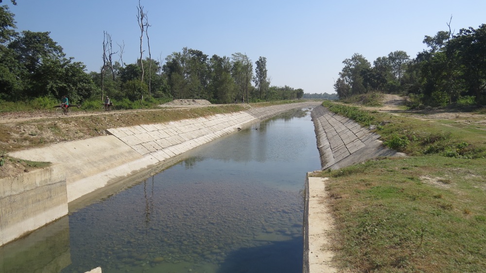
With more than 80 percent of people depending upon the subsistence agriculture for their livelihood, developing irrigation facilities in the southern plains of Kailali and Bardiya could substantially boost the crop productivity. For many years, these areas have been using water from Karnali River by means of temporary diversion structures [1]. Farmer managed irrigation scheme like Rani, Jamara and Khulariya systems have been diverting irrigation flows from the Kauriala branch, west bank of the Karnali [5]. However, a major flood in 1983 caused the eastern branch, Geruwa to be the major channel receiving all flows during the low flow period and most of the flood flows. Since then the farmers have been excavating 3 km channel each year to guide the flow towards west bank [4]. Although the 2009 monsoon forced river to revert back to its original dynamics with more flows now in the west branch [6], lack of any control structures is allowing uncontrolled flows carrying excess water and sediment to enter in the canal systems, thus making the system highly unreliable and ineffective in providing adequate and timely irrigation supplies. Similar is the case with the farmer managed ‘Budi Kulo’ irrigation scheme for the Rajapur area that diverts water from the east branch of Karnali.
With the support from World Bank (IDA assistance), Government of Nepal is now undertaking modernization of Rani Jamara Kulariya Irrigation Scheme by substantially rehabilitating and upgrading the main and secondary irrigation and drainage systems and flood management infrastructure including trainings to water users associations to improve their ability to manage water [7, 8]. A permanent side intake for diverting 100 cubic metres of flow from Karnali has already been constructed on the west bank of the river just downstream of the Karnali Bridge while most of the irrigation infrastructure and river protection works are underway and expected to get completed by the end of this year. In a next phase of the project, the system is likely to build new branch canal to Lamki and Pathariya west thereby covering a total cultivable command area of 38,300 ha of Kailali district [9]. Undoubtedly, this modernization project will improve the irrigation water delivery to and management in the project command areas and strengthen the community based water management practices. But the surface extraction is also likely reduce the habitat area and volume available to freshwater species. The irrigation flow of 100 m3 accounts significant portion of minimum flow in Karnali which usually reduces as little as 260 m3 during the month of February [10]. Nonetheless, this extraction is much lesser than it used to be from the older farmer managed irrigation scheme [11] with controlled sedimentation in the irrigation delivery. As the system will not be operating at full design capacity until the extension project is in place, flow velocities will fall quite low and hence sediment deposition will be relatively more than desirable [12].
While surface extraction may not “save” water, these canals will certainly provide other environmental services as a trade-off. Several recognized advantages include lesser flood risks due to river bank protection works, increased crop production, higher quality of life, and appreciation of land value and possibility of agro-based industries across the region. Beyond their economic and social utility, irrigation canals are part of a complex hydro-social system that appears to play an important role in maintaining the ichthyological biodiversity of rivers [13]. The circulation of water through the entire network of distributaries and irrigation ensure that the region’s main water tables are replenished [12]. Adverse impacts however, includes the loss of community forest areas and vegetation and permanent relocation of the settlements to the foothills making the people more vulnerable to landslides and debris flows from the Chure region.
Karnali Basin has so far the highest hydropower potentials among the Himalayan river systems in Nepal [14]. A study carried out by JICA in 1993 [15] identified six major reservoir sites, two each in its three major stems (Seti, Karnali and Bheri) including mammoth 4180 MW Upper Karnali Storage Dam Project and the 10, 800 MW Karnali Chisapani Multipurpose project. However, the only tangible progress so far seen is the Project Development Agreement (PDA) with GMR to build Upper Karnali Hydropower Project (900 MW) at the Karnali Bend. But this had already brought lots of criticism from water resources intellectuals as the project is likely to preclude the opportunity to implement the mammoth 4180 MW Upper Karnali Project [16]. Also the proposed alteration of design from a 300 MW run-off river scheme to 900 MW daily peaking scheme will bring alarming concern to the downstream irrigation project like Rani Jamara Kulariya particularly, during the critical flow period [17]. This clearly implies how the government and the key sectoral ministries like Ministry of Irrigation (MoI), Ministry of Energy (MoE) etc. develop their project plans standalone disregarding the holistic approach of basin planning and Integrated Water Resource Management (IWRM) principles. Although MoI demands a reregulating pond to be built for storing water in the tailrace of the project to harmonize the water flow downstream, there is a hesitancy from GMR as the cost of building a separate re-regulating pond may be too high compared to the potential earning from peak-hour energy [18]. This hesitancy and uncertainty can further hold-up the development of hydropower project in the region.
For now, very less is known and discussed as to how these proposed large scale hydropower development across the Karnali Basin will affect the existing socio-ecological set up, river morphology, hydrological behaviour and sediment dynamics of the river, since the focus is more on the supply of electricity rather than the ecological benefits of a flowing river. Considering the young geological formations of Siwalik and Middle Mountains which more susceptible to sliding, erosion and bedding plane failures, reservoir induced mass erosion, particularly reservoir bank erosion and landslides would be more severe in case of reservoirs located in Siwalik. So, as soon as the large scale projects like Upper Karnali and other storage projects becomes the reality, no doubt, there would be series of socio-ecological consequences with likely alteration of geomorphological and hydrological characteristics of the river. The one for all universal provision of 10 % ecological flow release will also be inadequate to conserve most freshwater species of the Karnali [19].
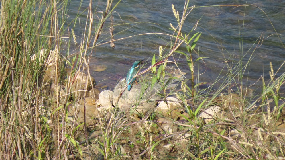
The dramatic elevational relief and the phenomenal changes in aqua-terrestrial ecosystems also makes Karnali region a globally important laboratory for freshwater and terrestrial biodiversity [20]. East branch of Karnali River marks the buffer zone for the Bardiya National Park while the River and forest corridor together serve as the transboundary corridors facilitating the movement of both terrestrial and aquatic animals, notably the threatened Gangetic dolphin and gharial populations [20]. Although some ongoing program like ‘Hariyo Ban Program’ funded by USAID are trying to restore these forest corridors and enhance wild life populations, and improve wellbeing of local communities through benefits from natural resources and payments for ecosystem services, large scale infrastructure development and wholesale encroachment on these forest corridors due to increased human socio-economic needs will continue to fragment the habitat further and threaten the very existence of aquatic and wildlife in the area, let alone their free movement [21].
Although much is known about water in Nepal, but there is still much to be learned. Lack of a comprehensive master plan/river basin plan will continue to impede realization of IWRM principles in water resource development and the management of water resources more effectively and sustainably in the Karnali River Basin. There is dire need for better water management but quality scientific data is missing. So the critical knowledge/research gaps to understand the complex river dynamics and their implications to the sustainable water resource management and biodiversity conservation require further exploration.
References
[1] Shrestha, D.L. and Paudyal, G.N., 1992. Water resources development planning in the Karnali river basin, Nepal. International Journal of Water Resources Development, 8(3), pp.195-203
[2] Shrestha, H.M., 2015. The Case of Upper Karnali Hydroelectric Project. Hydro Nepal: Journal of Water, Energy and Environment, 16, pp.14-17
[3] Prajapati, R.N., 2015. Delineation of run of river hydropower potential of Karnali Basin Nepal using GIS and HEC-HMS. Eur J Adv Eng Technol, 2(1), pp.50-54.
[4] Taylor et.al 2014. Assessment of Water Resources Management & Freshwater Biodiversity in Nepal. USAID/Nepal
[5] Department of Irrigation, 2011. Environmental Management Plan Final Report: Modernization of Rani Jamara Kulariya Irrigation Scheme Phase I.
[6] Dingle, E., Creed, M., Attal, M., Sinclair, H., Mudd, S., Borthwick, A., Dugar, S. and Brown, S., 2017, April. Predicting geomorphically-induced flood risk for the Nepalese Terai communities. In EGU General Assembly Conference Abstracts (Vol. 19, p. 9240).
[8] http://cmsnepal.org/index.php/author/cmsnepal/
[9] Department of Irrigation, 2016. Rani Jamara Kularia Irrigation Project: Brief Description and Status
[10] Department of Irrigation, 2016. Rani Jamara Kularia Irrigation Project: Brief Description and Status
[11] Department of Irrigation, 2011. Environmental Management Plan Final Report: Modernization of Rani Jamara Kulariya Irrigation Scheme Phase I.
[12] Munir, S., 2011. Role of Sediment Transport in Operation and Maintenance of Supply and Demand Based Irrigation Canals: Application to Machai Maira Branch Canals: UNESCO-IHE PhD Thesis. CRC Press.
[13] Aspe, C., Jacqué, M. and Gilles, A., 2014. Irrigation canals as tools for climate change adaptation and ichthyological biodiversity management: A case study of integrated development in Southern France.
[14] Shrestha, H.M., 2015. The Case of Upper Karnali Hydroelectric Project. Hydro Nepal: Journal of Water, Energy and Environment, 16, pp.14-17
[15] Nippon Koei, 1993. Master Plan Study for Water Resource Development of Upper Karnali and Mahakali River Basin
[17] http://www.nepalenergyforum.com/upper-karnali-project-will-impact-downstream-projects/
[18] https://thehimalayantimes.com/business/upper-karnali-alter-power-generation-mode/
[19] Taylor et.al 2014. Assessment of Water Resources Management & Freshwater Biodiversity in Nepal. USAID/Nepal
Comments