")
In this blog post, Dr. Dilip Gautam (Senior DRR Consultant – PAC) considers sediment and flooding dynamics within the Karnali basin. In most of the current flood risk management practices, the role of sediment dynamics is not dealt with sufficiently. Sedimentation of river channel and floodplain has serious impacts on aggravating flood risks in alluvial river system. This blog focuses on the relationship of sediment dynamics and flood risks in Karnali River basin of Nepal. The idea is to integrate sediment dynamics in flood forecast modelling and follow comprehensive approach on flood risk management with due consideration on control of erosion and sedimentation.
The extreme weather, diverse topography, fragile geology and seismic activities are natural causes of flooding in Nepal. About 80% area of Nepal is occupied by mountains and hills. The altitude varies from 60m to 8848m and the slope varies from less than 10% in Terai to more than 30% in mountains. There are five active tectonic zones traversing from east to west. The fragile geological condition contributes to landslides and erosion of hill slopes producing large amount of sediments. Extreme rainfall events trigger landslides (including slope failure, slumps, creeps, wedge failures), pluvial processes (including debris flows, debris slides, debris torrents, mud flows, mud slides, debris torrents with mud), and erosional processes including bank cutting, sheet erosion etc. The high sediment loads produced by landslides, pluvial process and erosional processes are carried by mountainous rivers aggravating the flooding problems in Nepal. Human intervention of natural environment such as deforestation, unscientific agricultural practices and land use changes, and developmental activities are further enhancing the intensity and magnitude of flood hazard. Socio-economic factors such as urbanization, population growth, poverty and illiteracy are compounding the flood disasters by increasing the exposure and vulnerability of the people and the infrastructures. Climate change is further enhancing the flood risk by altering the spatial and temporal pattern of precipitation. The spatial and temporal pattern of extreme precipitation events are changing and the rainfall intensities are in rising trend. The flood protection systems which are designed without considering the changing pattern of river bed level and sedimentation and increasing trend in rainfall intensities due to climate change are unable to cope with the extreme floods.
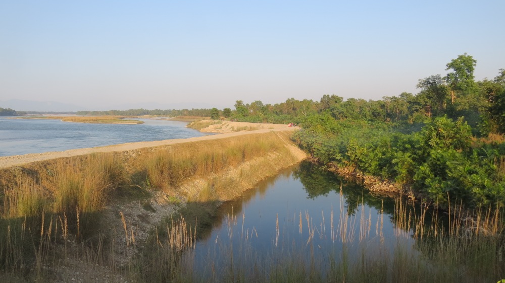
Karnali is one of the most dynamic rivers of Nepal. The dynamic nature of Karnali is seen by its erosive nature and high capacity to carry silts and sands from highlands. The tributaries of Karnali originated from Siwalik range carry large amount of sediments, causing their bed level to rise and changing their course frequently. As the rivers flow south towards the Terai, they deposit silt on flood plains and agricultural land.
Each flooding episode in Karnali River either deposits or erodes the sediments in the river bed and floodplain. There have been major flood events with the water level crossing the danger level in 1975, 1983, 1988, 2000, 2008, 2009, 2013 and 2014. 100 year return period flood on 15 August 2014 killed 222 people [1] and affected 120,000. The flood damaged infrastructures and properties and displaced households.
It is estimated that Karnali River provides about 25% of Nepal’s total runoff [2] and carries about 20% of Nepal’s total sediment load. Sediment load in Karnali River is estimated to be about 218 million ton per year [3]. Monsoon season (Jun-Sep) alone carries more than 90% of annual sediment load.
The consequences of flooding and sedimentation are the following:
- Loss of human life
- Damage to houses
- Damage to crops mostly paddy, vegetables, cereals resulting in food insecurity
- Damage to food stocks
- Damage to infrastructures (roads, bridges, canals, schools, hospitals)
- Siltation of irrigation canals, fish ponds
- Contamination of drinking water source (river, well, tube well, springs)
- Disruption of businesses
The early warning system which utilizes flood hazard maps to issue impact-based flood warning may have consequences of underestimating the floods if it doesn’t consider sediment dynamics.
The disaster risk reduction (DRR) managers and practitioners need to be aware of the negative consequences of sediment laden flooding in Karnali. They need to devise their intervention methods to address the impacts of both flood water as well as sedimentation in a sustainable manner. Some of the recommendations for DRR managers and practitioners are the following:
- Develop policy of ‘River Management’ based on Integrated Water Resources Management (IWRM) principles rather than policy of ‘River Control’
- Promote flood adaptive infrastructures (e.g. adequate drainage, houses on stilts, raised plinth level, raised hand pumps, raised toilets etc.)
- Promote community participation in flood management and mitigation
- Enhance public awareness and education on flood risks
- Develop flood risk maps and implement land use regulation on flood risk areas
- Promote construction of multi-purpose storage facilities for flood water and sediments (e.g. ponds, playgrounds)
- Take measures for reducing erosion and sedimentation such as conservation of upper watershed, afforestation, construction of bio-dykes etc.
- Promote flood resistant agriculture and alternative agricultural practices on sand deposited fields
- Diversify livelihoods for building resilience to disasters
- Develop guidelines for designing hydraulic structures to reduce flood risks considering the changing pattern of river bed level and sedimentation and increasing trend in rainfall intensities due to climate change
- Develop flood forecasting and warning system considering sediment dynamics
References
[1] Zurich, 2014. Risk Nexus, Urgent case for recovery: what we can learn from the August 2014 Karnali River floods in Nepal, Zurich Insurance Group Ltd and ISET-International
[2] WECS, 2011. Water Resources of Nepal in the Context of Climate Change, Water and Energy Commission Secretariat, Government of Nepal
[3] Kafle, K. R., Khanal, S. N., Dahal, R. K., 2015. Dynamics of the Koshi River on the Perspective of Morphology and Sedimentation with Emphasis on Post Disaster Impact of the 2008 Koshi Flood, Kathmandu University Journal of Science, Engineering and Technology, Vol. 11, No. 1, August, 2015, pp 71-92
Comments