Nepal’s July rainfall has been the highest for a decade, resulting in deaths, displacement and loss of livelihoods. Government and civil society work on end-to-end Early Warning Systems has reduced the impact of the floods in some areas, but others are still vulnerable and more investment in flood resilience is needed.
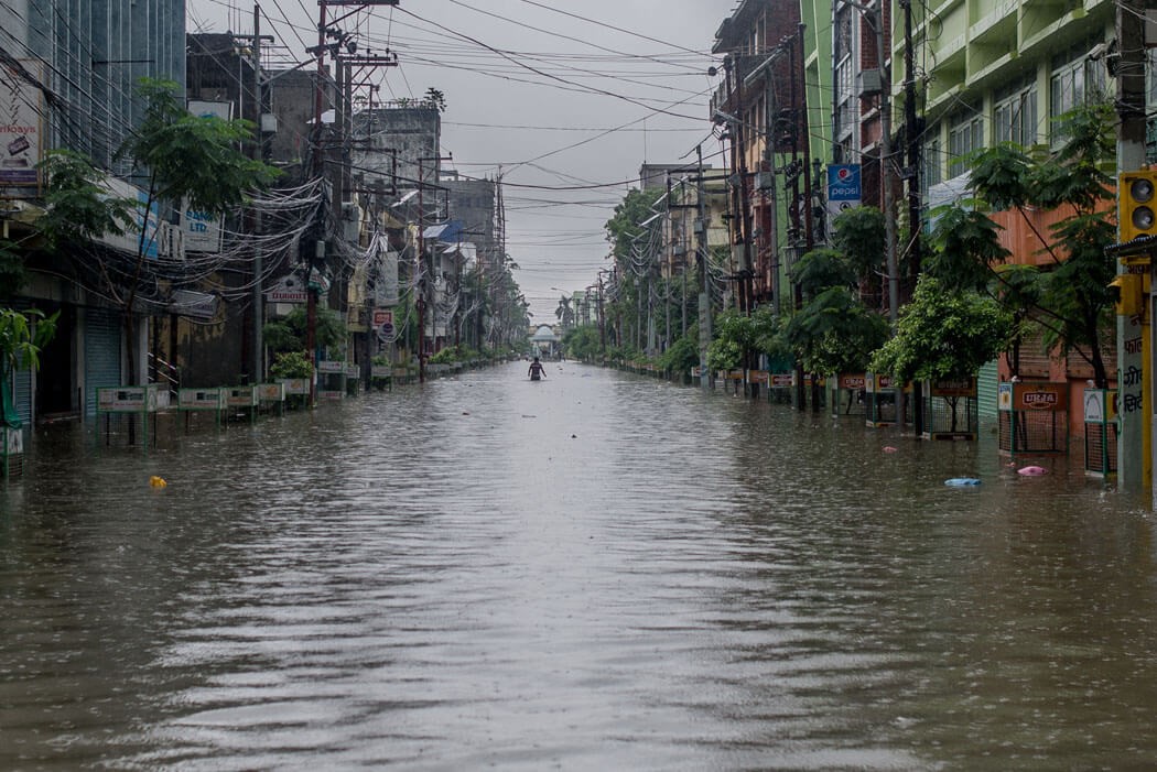
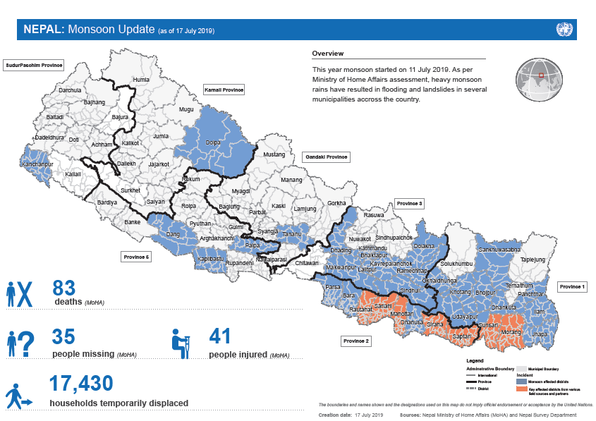
Floods and landslides are a regular phenomenon in Nepal during monsoon season, when the country receives more than 80 percent of its annual rainfall. This year, the monsoon entered Nepal in the third week of June and a month later the country received the heaviest rainfall of the decade. Starting on 11 July, a week-long incessant rainfall triggered flooding and landslides in several parts of Nepal. South-eastern districts of Provinces 1, 2 & 3 were worst affected.

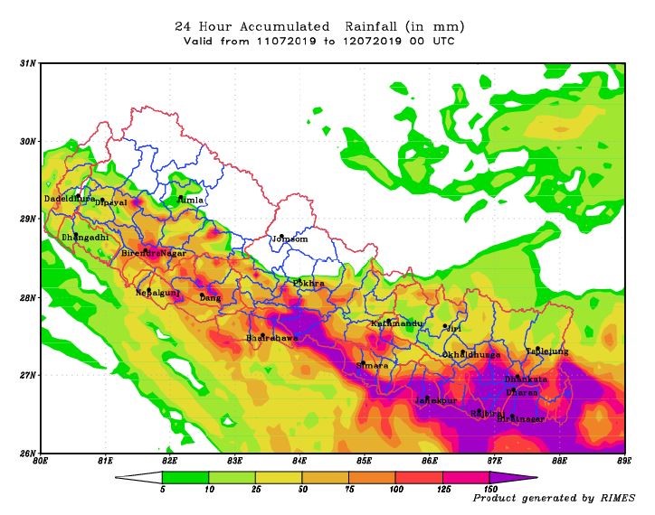
Several stations in the Bagmati and Kamala river basins recorded rainfall of more than 250 mm in 24 hours. Considering the coverage and duration of rainfall, this is a historical extreme across these basins in the last three decades. The Bagmati and Kamala rivers crossed Danger Level while several other Chure-fed rivers swelled up enormously, bringing huge devastation in several regions of Eastern Nepal.

This monsoon has already claimed the lives of 83 people, 35 are still missing and 41 have been injured. An estimated 17, 430 households have been temporarily displaced. Initial rapid assessment is undergoing and more details on the physical damage and economic losses are yet to come. However, considering the rainfall extremes and its coverage, huge economic losses can be expected.

Poor urban planning increases flood risk in Kathmandu
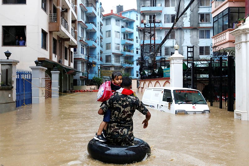
Kathmandu has also been hit by severe flooding. Around 150mm of rainfall in 12 hours brought floods in several river corridors of the capital. Hundreds of families have been affected and some areas surrounding Balkhu and Kuleshwor witnessed levels of flooding never seen before. The valley’s haphazard urbanisation and reckless land use are to blame for the increased severity of floods being observed in Kathmandu in recent years.
Human settlements have cropped up in the river’s right of way and the rapid urban sprawl in the flood plains of Bagmati, Bishnumati, Dhobikhola, Balkhu Khola and several other river corridors have interfered with the natural flow of the rivers, making flooding a recurrent issue. With more months of monsoon still to come, elevated rainfall like this can bring additional devastation in the areas where the soil is already saturated and rainfall can translate to runoff in no time.

Early Warning Systems have helped lessen the impacts
Whilst floods wreaked havoc in several parts of the county, loss of human lives due to flood has been less compared to floods in 2017 and 2018. Communication of weather and flood forecasts appear more organized and efficient compared to recent years, with regular forecast bulletins sent out to all tiers of governments and key stakeholders well in advance of floods. As soon as the monsoon trough and low pressure zone started forming near the southeastern plains and Midhills of Nepal, the Department of Hydrology and Meteorology (DHM) was brought in. A 24h operation and regular communication was established with the Ministry of Home Affairs (MoHA) and other authorities about possible flood risk in the country.
As rainfall stations and hydrological stations started recording heavy rainfall and rivers reached warning levels, SMS alerts were sent to the most vulnerable areas of Bagmati and Kamala river basins. This provided a few hours of lead time for emergency response and evacuation of at-risk communities.
Last year an end-to-end flood early warning system was set up in the Kamala river basin through the joint collaboration of DHM, Practical Action and the Nepal Red Cross district chapters. It has proved to be instrumental in ensuring flood warnings are reaching the most vulnerable and are acted upon effectively and in a timely manner by communities.
More investment still needed to manage flood risk
A large proportion of flood vulnerable communities, particularly those living in the flood plains of Chure-fed rivers, remain detached from these kind of early warning systems. The DHM is implementing 3-day weather and flood forecasting but more efforts are necessary to make this forecast information actionable. The MoHA, as the focal body for disaster response, needs to realign its disaster preparedness and response operations based on the available forecast information.
Evacuation during flood events is always challenging, as travel routes get inundated and become vulnerable. Understanding flood exposure and vulnerability levels, with contingency plans in place to evacuate beforehand, is essential. This requires strengthening and updating of flood risk information. We lack a comprehensive hazard mapping and scientific identification of vulnerable areas, which has limited our efforts to predict flood impact and undertake emergency preparedness and evacuation well in advance of flood event. Learning from past events is critical in this aspect.
Read more about the work Practical Action is doing as part of the Zurich Flood Resilience Alliance.


Comments